Coordinate Transformation Tool™
Program for common GPS transformations for geodetic uses. it enables survivors to Fit their GPS measurements from the WGS’84 Datum to any Local Datum in the world.
Main Features:
Transformation Model
- This Software Application calculates the Spatial Transformation Parameters using the Least Square Adjustment Method in order to fit the GPS measurements to a specific datum.
- It supports different file formats for Input and Output.
- It offers a Transformations Model for using RTK.
- The application automatically separates the control points from the input, calculates the unknown points coordinates and prints these in the reports.
Least Square Undulation Model
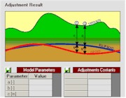
- This software application calculates a Local Undulation Model N= H-h. H indicates an Ellipsoidal Height, h indicates an Orthometric Height.
- The calculation is based on Least Square Adjustments Computations.
- Undulation might be a plane formula, parabola or polynomial.
- The application automatically separates the control points from the input, calculates the unknown points’ Orthometric height and prints it in the reports.
Design Consideration:
- The project was developed using the VB environment aware to its advantages and limitations.
- Planning for change, The GEO-GRID OCX component was developed especially for the CTT to and handle Surveyors GEO Data, such component can be used for future developments.